
| Main Page -> Maps -> Sebastian Munster - Gallia |
|
|
|
A higher resolution scan of the map. - 499156 bytes
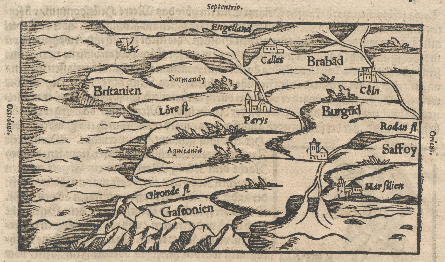
A correlation between map place names and their modern equivalents:
| Aquitania | - | Aquitaine (Part of France at the creation of this map) |
| Burgud | - | Bourgogne - Burgundy |
| Brabad | - | Brabant (on border of Netherlands and Belgium) |
| Britanien | - | Brittany (Part of France when this map was engraved) |
| Calles | - | Calais |
| Coln | - | Koln / Cologne (Germany) |
| Engelland | - | England |
| Gafconien | - | Gascogne / Gascony |
| Gironde fl | - | Garonne River |
| Lore fl | - | Loire River |
| Marfilien | - | Marseille / Marseilles |
| Normandy | - | Normandy |
| Occidens | - | West |
| Oriens | - | East |
| Parys | - | Paris |
| Rodan fl | - | Rhône River |
| Saffoy | - | Duchy of Savoy (1416 - 1714) |
| Septentrio | - | North (from the latin septentrion) |
| - | Seine River (near Parys) | |
| - | Rhine River (near Coln) | |
| - | Pyrenees Mountains |